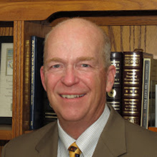
I blogged earlier this week about PulsePoint, a remarkable application that uses location-based services to deliver CPR alerts to nearby citizens who could potentially be rescuers. There is an interesting back story to PulsePoint, by it’s founder, Richard Price.
He tells the full story in this 12 minute TEDx, but here’s the condensed version: he’s the fire chief in San Ramon Valley, California. One day he’s grabbing lunch at a deli when he hears sirens approaching. One of his own rigs ultimately pulls up right outside the deli and the crew jumps out and attend to a sudden cardiac arrest in the shop next door. Had he known about it, he could have been there almost immediately and rendered care to the patient until more help arrived.
The experience made Chief Price think about how he might be able to use the concept of location-based services to notify willing citizens of these events when they occurred in public places nearby. CPR by a bystander is critical to improving the odds of survival. Perhaps the geo-aware feature of the smartphone could harness the good will of many who would gladly help save a life if the opportunity presented itself.
This is a brilliant application of location-based services, and one that has and will continue to save lives. Interestingly, Chief Price had this thought at about the same time as I did, back in November of 2009 when the concept of P3i jumped into my head as I used Google maps to navigate to the nearest craft brewery in Los Angeles on a business trip.
Two chiefs, same idea, both in need of some iOS and Android developers. One was a pretty good idea for its time, which was at the dawn of the modern smartphone. The other was a genuine life saver. Doubt that? Google “PulsePoint saves”.
This post was originally published on October 16, 2015 on Director Casady’s blog.